Why I'm attempting the 100 Mile NPS Paddle Challenge

The news that these people had left their own country to bathe in the river Jordan, spread among all the kings and chiefs of Florida, and as they were an ignorant people, they all set out in search of this river, which was supposed to possess the power of rejuvenating old men and women. So eager were they in their search, that they did not pass a river, a brook, a lake, or even a swamp, without bathing in it; and, even to this day, they have not ceased to look for it, but always without any success.

- Memoir Of Hernando D’Escalante Fontaneda 1575

I'm not expecting to find the Fountain of Youth, but I needed some kind of cross training upper body workout to supplement (i.e. give my knees a break) my long distance running. As with signing up for a marathon it is simply a way of maintaining my motivation to keep exercising. I much prefer training outside versus working out in a gym. So kayaking (and the occasional period oared powered vessel), seemed like a good fit.

Sunday, June 26, 2016

Emerson Point Preserve


De Soto National Memorial is a small unit, of  26 acres with only about about three-quarters of a mile of coast line.  Unlike most of the other parks in the Paddle Challenge, one is going to have to go a bit beyond the Park proper, or do a lot of circling, to rack up those challenge miles.  Almost due North of De Soto's kayak launch is Emerson Point about half-a-mile across the Manatee River where it empties into Tampa Bay. There is a  noticeable observation mound located on the point.  The rubble from a failed and demolished condominium project was left in place and covered over to form the mound.  The point became  Emerson Point Preserve a park well worth visiting whether by paddle, on foot, bicycle or automobile.


Emerson Point in the background across the river channel.


 Some years ago I'd experienced the thrill of making that crossing, in armor in a rowboat for Snead Island Heritage Days.  Although not quite Tim FitzHigham's epic crossing the English Channel in a bathtub it had its moments as when large and or high-speed boats with some serious wake action and swells large enough to expose the paddle rudder out the water.


Crossing the river and rowing like soldiers , not sailors.

 But today the river was calm, little boat traffic in the channel and the crossing uneventful.

View of De Soto National Memorial across the river from the observation mound.
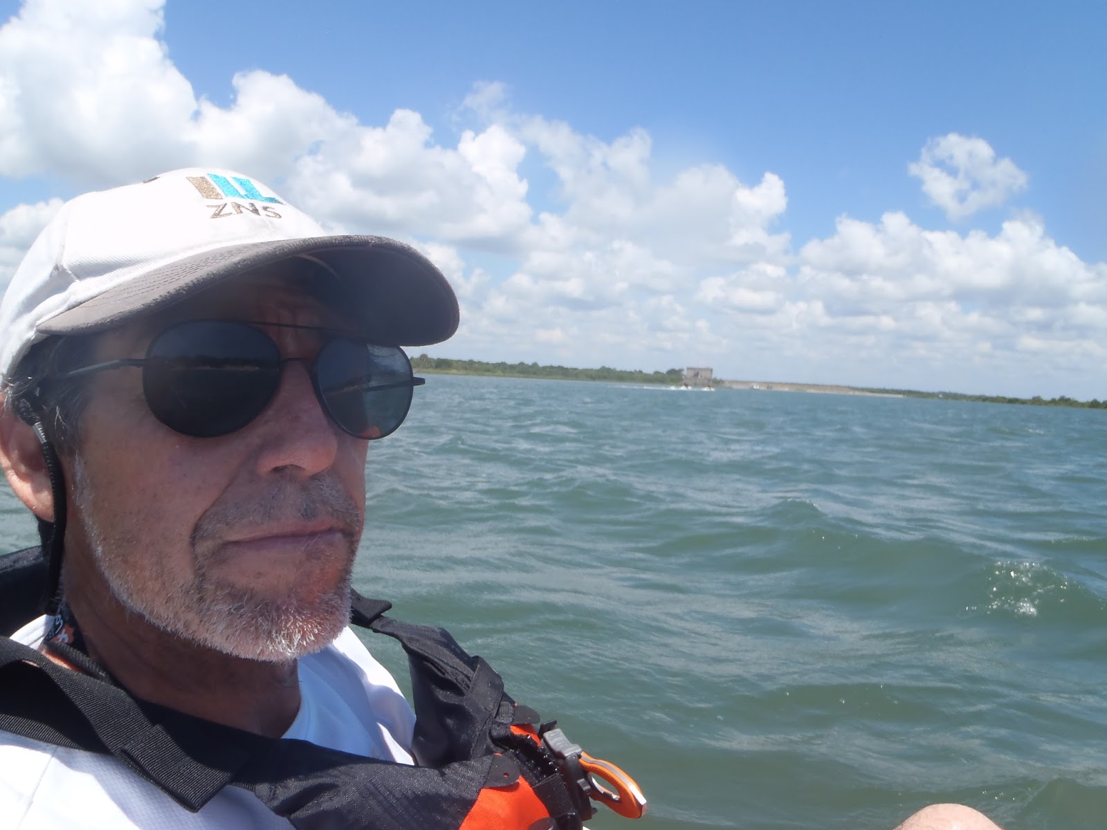
Required selfie on the river.  De Soto National Memorial in the background.  The Cross is barely visible on the shoreline to my left.

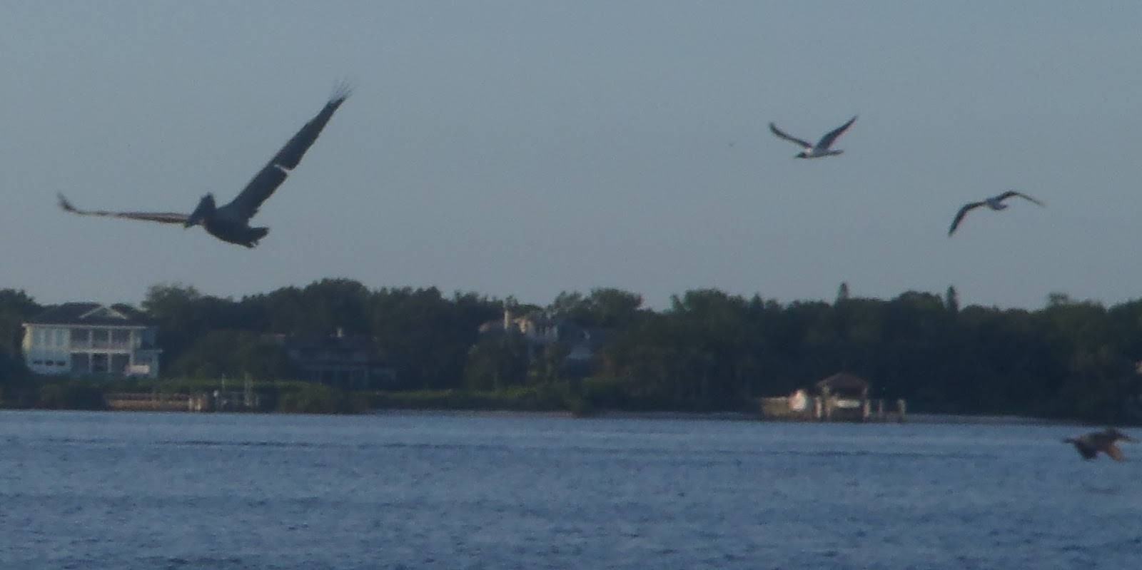
At Emerson Point I spotted some pelicans and gulls. There is a nice sand beach area there at the point for landing /launching kayaks if you are looking for a break after the crossing.


 From the Point I headed east , along the north side of the river to the Portavant Mound Complex.  It's about 1.3 miles as a straight shot or about 1.5 miles if you closely follow the coastline.  Alternatively its just under a mile, bearing N65 E from Shaw's/ De Soto Point if you want a direct shot.

The Dock at the Portavant Mound


Although it is about 25 feet high the Portavant Mound is so covered trees and brush that it all but invisible from a paddler's perspective. However, there is a dock located on the river at the mound site.
Beach  landing at the Portavant Mound.


After stretching my legs by walking up the mound's board walk, I paddled west along the river's edge, hoping to catch some wildlife.

Looking west to the end of the river and into Tampa Bay.


 A cool feature of the picnic pavilion at the base of the observation mound.  The posts are concrete casts of palm trees.  The original plan was to have several of these around the base and a couple on top of the mound. From the perspective across the river at De Soto NM it would have looked like an Indian village. A very cool idea., IMHO.  Somehow this construction ran afoul of FEMA watershed regulations - though how an open post structure at the edge of a 2500 ft. wide river could possibly restricted water-flow is beyond me - and other than this one shelter it was never built.


Picnic Pavilion at the base of the observation mound.


I've still have  a very different north side of Emerson Point Preserve and Terra Ceia Bay to cover  in a future post.


DESO

#FLNPS100PaddleChallenge and #FindYourPark

Sunday, June 19, 2016

Father's Day


 The whole family went out on a ranger led kayak tour at De Soto National Memorial.  It was a fully booked tour, and the skies were looking worrisome cloudy and the Manatee River quite choppy this morning.  Eventually though the skies cleared and we had a sunny paddle.


Daddy in front of the De Soto Trail marker.


 After the safety and procedure briefing the tour group launched their kayaks and headed for the cove.

More of a family photobomb than the picture I was trying to get.


 Other than some crabs in the mangroves we didn't see any wildlife this time out.


Kayaks stacked on the beach.
Jenn and Kate


Mid-way through the Ranger led the group on a tour of the monuments and mangrove channel before we got  thirty minutes of free paddle time.


Explaining a bonk on the head post  capsizing.


Kayak Triumph!


DESO

#FLNPS100PaddleChallenge and #FindYourPark

Sunday, June 12, 2016

Erosion


An occupational hazard of Land Surveyors is always to be on the lookout for survey markers.  it becomes instinct   - I found myself spotting them in Spain - not that I'd ever have occasion to need to use them.  So why not paddle selfies next to survey markers.

Can you spot the orange carsonite witness post?  Left edge of the photo by the tree.
See the survey marker sticking up out of the water?  
It is hard to read the brass disc -C38 Line 3 US CE 1779 - if you are curious. 
'Looking across the river towards Emerson Point

 
The marker at Shaw's Point is even  more extreme example of erosion at work.
Paddling past the nearly submerged marker at Shaw's Point.

 This is how the beach looked in 1960, before the Visitor's Center was constructed

Aerial view of the landing reenactment in March of 1960.

.And today, a view of the same area from the water.

Rock armoring against erosion at the north end of De Soto National Memorial


Evidence Hernando de Soto's original landing site in 1539 has never been found archaeologically in the area of the Memorial, or anywhere else for that matter.  His base camp which was occupied by some 600 men and 220 horses should have left some evidence, but perhaps it has just eroded away into the ocean over the past centuries.


DESO

#FLNPS100PaddleChallenge and #FindYourPark

Fort Caroline National Memorial & The Timucuan Preserve

Last  park on my trip was  Fort Caroline NM which I hadn't been to since filming the History Channel's Conquest of America.  So I had to get this Park in my Paddle Challenge itinerary.  I launched from the Fulton Landing boat ramp about a half mile west of the Fort Replica. Paddled past the bluffs where the Ribault Column is located and back.  I was worried that since this was a shipping channel it might be rough but in fact a surprisingly peaceful morning paddle.

At the  Fort Caroline Visitor's Center gave me a couple of suggestions for additional paddling.  I choose to hit the Cedar Point boat ramp and then head for home.

 
The River side of the wall protecting Ft. Caroline

The Cedar Point area of Timucuan Preserve


FOCA 

 TIMU

#FLNPS100PaddleChallenge and #FindYourPark

Castillo de San Marcos National Monument


 Moving up the coast I arrived in St. Augustine.  In the morning at high tide I launched at the Vilano boat ramp.  Note, "high tide" this area can have as much as a four foot difference between high an low tide on a regular basis.  At high tide it was easy enough to make my way though the needlegrass flats along the west shore of the St. John's River past the Fountain of Youth, the Great Cross, and to the Castillo itself.  At low tide I would have been dragging across oyster beds.  On my return I used the main channel and found it little different from  negotiating the Manatee River in contrast from Matanzas on the previous day.


The Great Cross at the Mission de Nombre de Dios in the background.

 
The Fountain of Youth Archaeological Park


Replica Spanish boat.
I did mention that I was in town for a reenactment.


 My camera lens got wet and couldn't get a good selfie at the Castillo proper - but I did get chance to visit later on.


CASA

#FLNPS100PaddleChallenge and #FindYourPark

Fort Matanzas National Monument


 The second park on my paddle adventure list was Fort Matanzas NM.  I'd been warned from googling paddle launch sites that the Matanzas inlet could be rough and in this case it certainly was.  Even with a good stiff wind against my back it took 30 minutes of hard paddling just to get to the Fort itself (about half a mile)  though it got easier as I passed the Fort.  I think it took about 10 minutes to get back to my launching site at the board walk.  At times it seemed that I was making no progress and I was tempted to ground the kayak and just walk it along the beach. 


Ft. Matanzas in the background, by the time I got a decent photo I'd drifted quite a bit.

 I did see some dolphins feed in the inlet, but luck getting photos.


FOMA

#FLNPS100PaddleChallenge and #FindYourPark

Canaveral National Seashore


Canaveral National Seashore the first stop on my Northeast Florida paddle/reenactment trip.  I arrived at the park at first light and was advised by the ranger at the gate that parking lot 7 was the best spot to launch from.  It was a beautiful morning, calm and very few motorized craft in use.  

Canaveral National Seashore a bit north of the VC


  It was a pretty uneventful paddle, I was fearing that the only wildlife I was going to be able to record were  the gnats in the parking lot (awful - but once I was in the water the insect assault ceased).  I was approaching the landing at parking lot 6 to get out and stretch my legs, when I spotted a manatee.

I spotted a manatee.

     Evidently there was in fact a pod (? that is the correct term for a group of cetaceans isn't it?) (google checked and Manatees are in fact Sirenians  and a group of them  is called an aggregate) and I seem to have spooked them.  All of the sudden, the water erupted, with a gray swirling mass and frothing , foaming water.  I wish I had video rolling, it seemed that the kraken had been released, I got soaked, and can well imagine how being attacked by a sea serpent stories get started. It only lasted a few seconds and I was glad that tentacles and teeth were not involved.

The aftermath


CANA

#FLNPS100PaddleChallenge and #FindYourPark

Down River to Robinson Preserve


 Launching from De Soto NM  round trip to Robinson Preserve to the west.  Another dead calm morning and easy paddle.


 Bird flew away before I could get a photo.


DESO

#FLNPS100PaddleChallenge and #FindYourPark

Monuments on the Cove


 Anyone paddling around the cove at De Soto NM is certain to notice a couple of tall objects poking  above the tree line at the south end of the Park's shoreline.


View of the monuments from the cove.

The Obelisk


The Memorial Cross


 If you go ashore there is a wayside maker explaining the origin of the monuments formally known as the Holy Eucharist Monument and Memorial Cross.  

Wayside


De Soto National Memorial | MONUMENTS | - National Park Planner


DESO


#FLNPS100PaddleChallenge and #FindYourPark

Boarded by Dogs


 A dead calm morning and easy paddling at De Soto National Memorial.

The sign at the cove side trail entry to the Park.

 My kayak was boarded by dogs, very friendly dogs, when I neared the shoreline for this photo.


 DESO

#FLNPS100PaddleChallenge and #FindYourPark