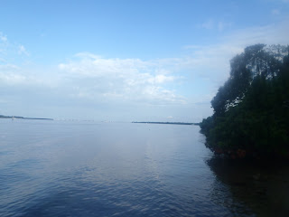
De Soto National Memorial is a small unit, of 26 acres with only about about three-quarters of a mile of
coast line. Unlike most of the other parks in the Paddle Challenge, one is going to have to go a bit beyond the Park proper, or do a lot of circling, to rack up those challenge miles. Almost due North of De Soto's kayak launch is Emerson Point about half-a-mile across the Manatee River where it empties into Tampa Bay. There is a noticeable observation mound located on the point. The rubble from a failed and demolished condominium project was left in place and covered over to form the mound. The point became Emerson
Point Preserve a park well worth visiting whether by paddle, on foot, bicycle or automobile.
 |
| Emerson Point in the background across the river channel. |
Some years ago I'd experienced the thrill of making that crossing, in armor in a rowboat for Snead Island Heritage Days. Although not quite Tim FitzHigham's epic crossing the English Channel in a bathtub it had its moments as when large and or high-speed boats with some serious wake action and swells large enough to expose the paddle rudder out the water.
 |
| Crossing the river and rowing like soldiers , not sailors. |
But today the river was calm, little boat traffic in the channel and the crossing uneventful.
 | |
| View of De Soto National Memorial across the river from the observation mound. |
 |
| Required selfie on the river. De Soto National Memorial in the background. The Cross is barely visible on the shoreline to my left. |
At Emerson Point I spotted some pelicans and gulls. There is a nice sand beach area there at the point for landing /launching kayaks if you are looking for a break after the crossing.
From the Point I headed east , along the north side of the river to the Portavant Mound Complex. It's about 1.3 miles as a straight shot or about 1.5 miles if you closely follow the coastline. Alternatively its just under a mile, bearing N65 E from Shaw's/ De Soto Point if you want a direct shot.
 |
| The Dock at the Portavant Mound |
Although it is about 25 feet high the Portavant Mound is so covered trees and brush that it all but invisible from a paddler's perspective. However, there is a dock located on the river at the mound site.

Beach landing at the Portavant Mound.

After stretching my legs by walking up the mound's board walk, I paddled west along the river's edge, hoping to catch some wildlife.
 |
| Looking west to the end of the river and into Tampa Bay. |
A cool feature of the picnic pavilion at the base of the observation mound. The posts are concrete casts of palm trees. The original plan was to have several of these around the base and a couple on top of the mound. From the perspective across the river at De Soto NM it would have looked like an Indian village. A very cool idea., IMHO. Somehow this construction ran afoul of FEMA watershed regulations - though how an open post structure at the edge of a 2500 ft. wide river could possibly restricted water-flow is beyond me - and other than this one shelter it was never built.
 |
| Picnic Pavilion at the base of the observation mound. |


No comments:
Post a Comment